


📍 Survey Smarter, Not Harder — Precision Meets Power
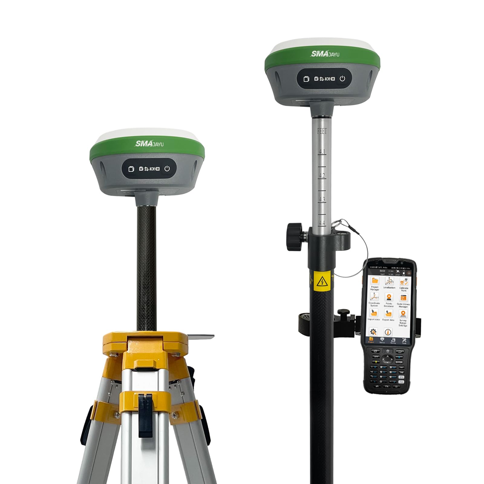
The R26 V1 NOAA GNSS IMU RTK GPS Land Surveying Equipment delivers industry-leading 0.5cm accuracy certified by NOAA, ensuring reliable and precise geospatial data collection. Featuring broad protocol compatibility and extensive file format support, it integrates seamlessly into diverse surveying workflows. With a 5-inch touchscreen LCD and Bluetooth connectivity, this rover-base system is designed for professional surveyors demanding precision, flexibility, and expert support.
| Display Type | LCD |
| Control Method | Touch |
| Are Batteries Included | No |
| Connectivity Protocol | Bluetooth |
| Screen Size | 5 Inches |
| Additional Features | Bluetooth |
| Connectivity Technology | Bluetooth |
| Map Types | Topographical |
A**A
Reliable & very accurate!!!
Point location is quick & accurate. The tilt feature enables location of building corners under overhangs. The data collector contains a lot of options with good survey programs (line stakeout, point stakeout, inverse between points, etc.). Very satisfied with the purchase for everyday business use!
J**N
Junk
No directions. Horrible crap!!
G**A
Buena tienda
Equipo muy bueno llena la espectativa!!!!
Trustpilot
3 weeks ago
3 weeks ago